-40%
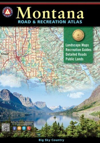
Montana Road & Recreation Street Atlas (BM)
$ 21.12
- Description
- Size Guide
Description
NEW 3rd Edition is Now Available!Montana is the crown jewel of the American West. Experience Big Sky Country with our completely new 3rd edition Montana Road & Recreation Atlas. No other map product can better portray Montana's rugged peaks, majestic rivers, and expansive plains. Large-scale Landscape MapsTM reveal landforms with amazing realism and detail, clearly showing the state’s vast network of roads, waterways, and recreation landmarks. A 30-page Recreation Guide provides regional maps with public land detail and lists a wide range of outdoor activities. Arranged by category and boasting unequalled insight and detail, it is the ideal tool for planning and executing Montana exploration.
Benchmark field-checkers drove thousands of miles to make sure the Montana Road & Recreation Atlas is the most accurate, comprehensive, and reliable map product ever published for Big Sky Country.
Landscape Maps
NEW base maps with land cover (vegetation)
NEW State/BLM map detail and boundaries for USFS private inholdings
Extensive road detail, field-checked for accuracy
Superior scales and page-to-page map overlap
Recreation Guide
Regional maps with public land ownership, hunting units, and point-to-point mileages
Categorized listings for:
National Parks & Monuments
State Parks & Recreation Areas
Historic Sites & Museums
Camping, Cabins, & RV Parks
Fishing & Boating Access
Statewide Hunting Regions & Units
128 pages, saddle-stitched; Cover dimension: 16”x11” 3rd Edition 2017. ISBN 978-0-929591-17-9
Map Scales:Recreation Maps 1:800,000 1" = 12.6 miles. Landscape Maps 1:250,000 1" = 4 miles.
